Explore our platform
Discover the power of Optioneer, interact with the platform and learn about functionality that accelerates your infrastructure planning and development processes.


Understanding the technical workflow
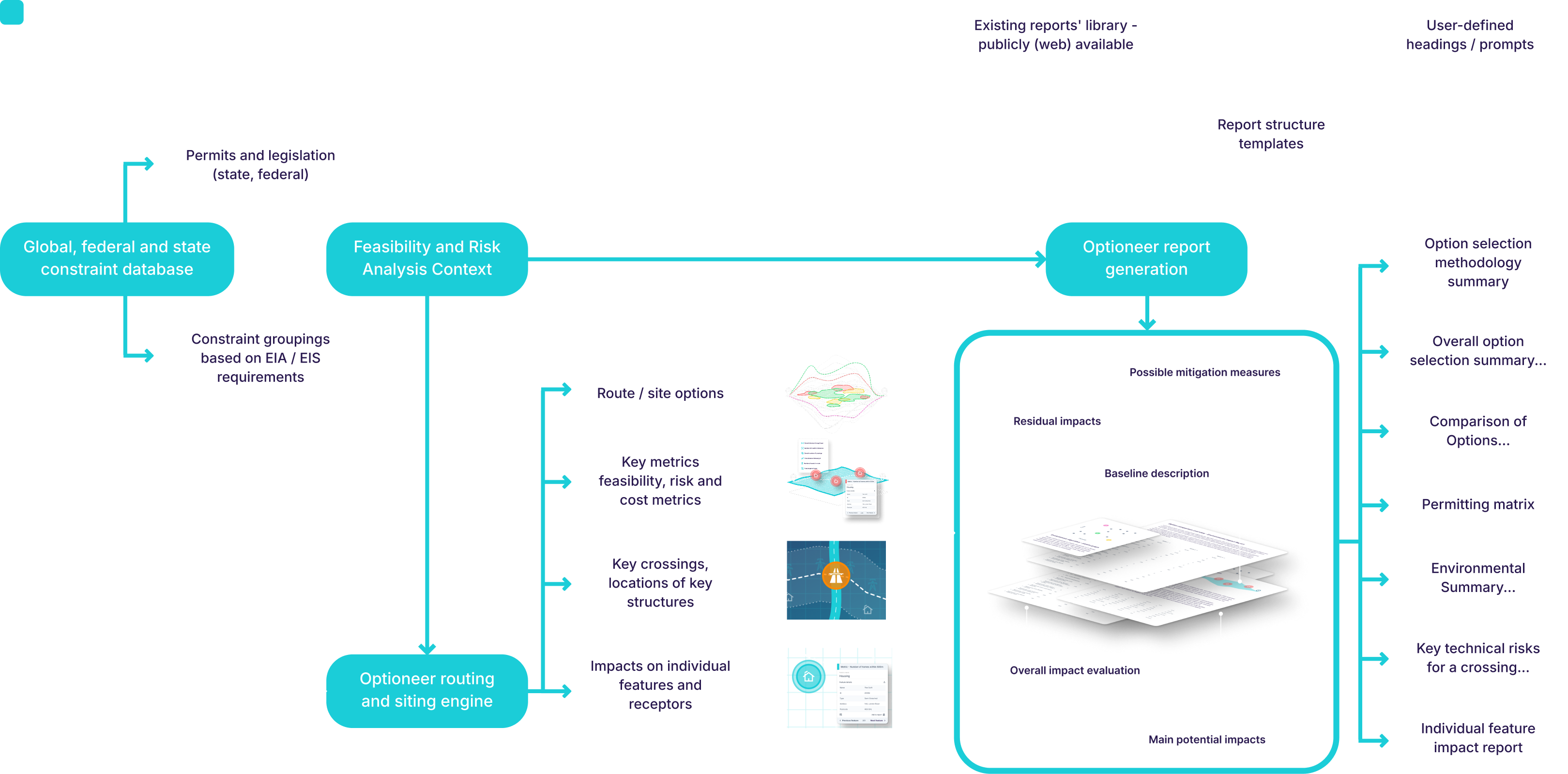
Optioneer is a versatile tool, useful across various aspects of infrastructure planning and project stages. The core workflow can be summarised as follows.
Data
Add datasets to your project space.
Parameters
Configure the key parameters for your assets and options.
Create options
Option generation and evaluation stage.
Analysis
Review and compare options against key criteria.
Reporting
Evidence the decision making process and prepare deliverables.
Common data environment for infrastructure planning

Make the right decisions for your network in the long-term.
Optioneer is a spatial common data environment designed for early-stage infrastructure planning. It provides a shared geospatial workspace where engineering, planning, and development teams can collaboratively assess feasibility and design network expansion.
The platform integrates more than 10,000 datasets covering existing infrastructure, environmental constraints, land ownership, planning frameworks, and regulatory information across the US, UK, and EU.
In addition to the built-in data layers, users can also upload and manage their own datasets. Optioneer supports key geospatial standards, ensuring interoperability with existing GIS workflows and external data sources.
Integrated spatial data catalogue
Public, open-source, continuously updated, and proprietary datasets relevant to infrastructure development.
Structured geospatial data model
Data is organised into thematic groupings that are immediately usable in spatial analysis and optimisation workflows.
Regulatory and permitting context
Infrastructure constraints are linked to relevant legislation, permitting frameworks, standards, and best-practice guidance, supporting early feasibility assessment.
Public and private data integration
Projects can combine open datasets with proprietary sources, including detailed land parcel data (US) and organisation-specific infrastructure data.
Interoperability with industry platforms
Compatible with systems such as ArcGIS and Autodesk Construction Cloud, allowing data exchange with downstream GIS, engineering, and BIM environments.
Data-backed optioneering
Optioneer comes with a wealth of pre-loaded GIS datasets. Our library is extensive, in-depth and up-to-date. Your project comes ready with friction-free, solid baseline datasets allowing you to make informed decisions, without the management overhead.
Interactive mapping and visualisation
Make the right decisions for your network in the long-term.
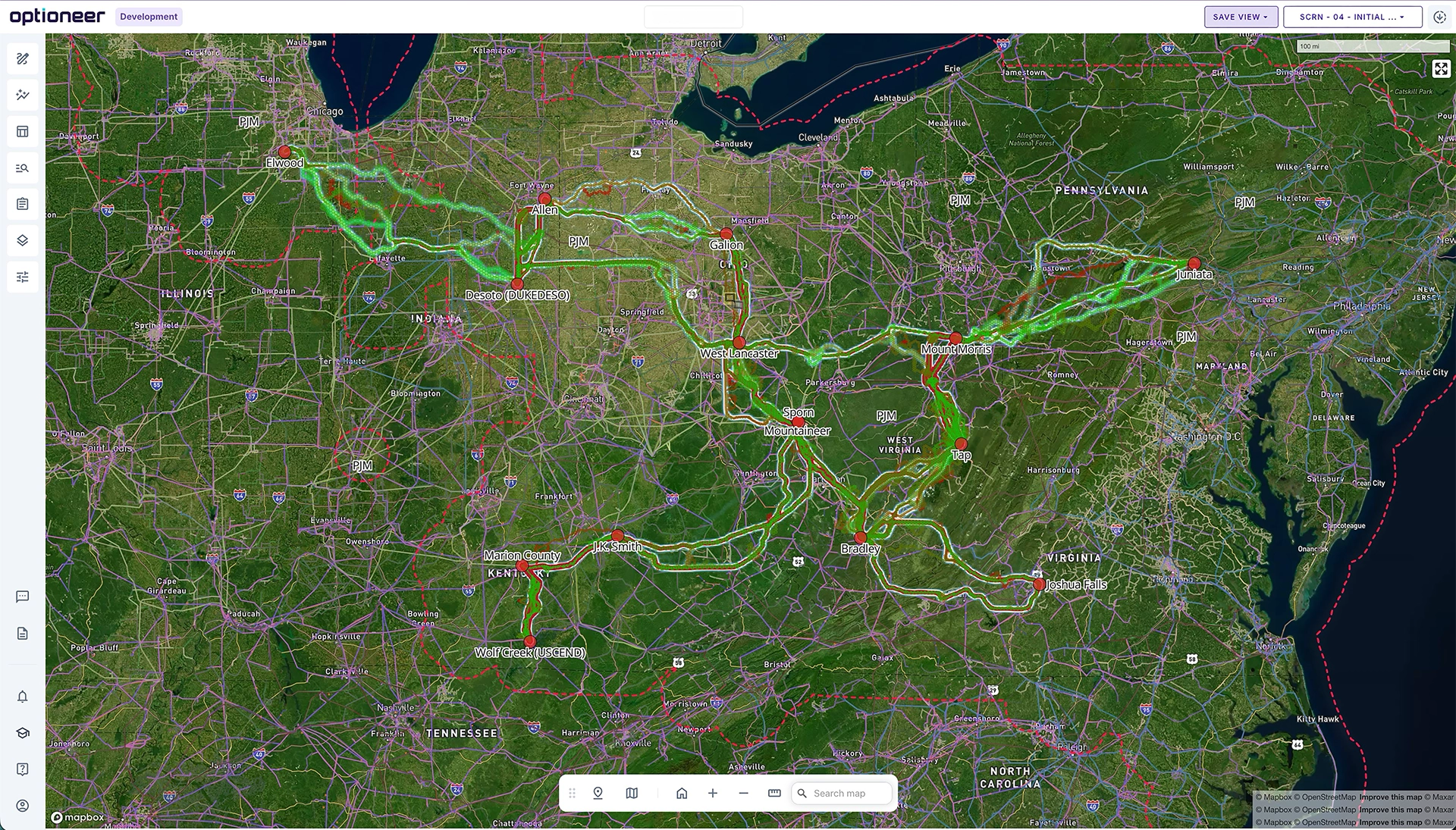
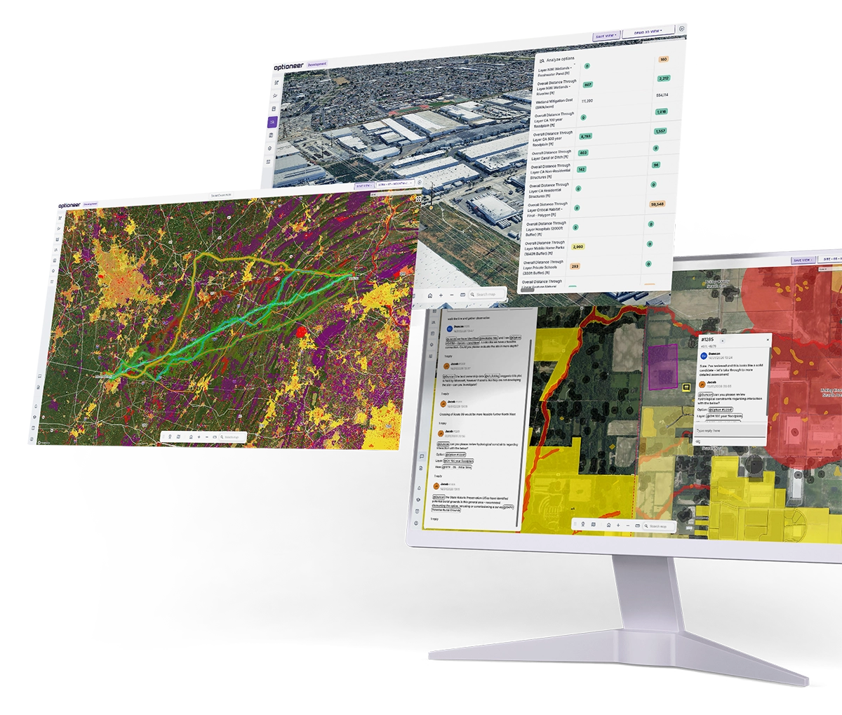
Optioneer is a high-performance, web-based geospatial visualisation engine built specifically for large-scale infrastructure projects. It enables users to explore and interact with extremely large spatial datasets directly in the browser, without compromising performance or usability.
The platform is capable of rendering thousands of layers and billions of geospatial features simultaneously. Our customers routinely use Optioneer to analyse infrastructure networks across entire regions, such as the PJM Interconnection in North America or the British Isles.
A wide range of geospatial data types can be rendered, styled, and combined within the platform. Optioneer also supports advanced 3D visualisation, allowing users to view terrain, key structures, conductors, and other infrastructure assets in a detailed and intuitive spatial context.
Scalable web mapping architecture
- Cloud-based SaaS platform
- Efficient rendering of large spatial datasets
- Support for up to 10,000 layers per project
3D terrain and infrastructure visualisation
- Terrain-based 3D rendering
- Photorealistic terrain visualisation
- Support for 3D .kmz infrastructure models
- Parametric rendering of infrastructure assets
Flexible geospatial data support
- Vector datasets
- Raster datasets
- WMS services
- Integration of external infrastructure layers such as OpenInfraMap
Cartographic export
- Map exports to PDF
- Full control over symbology and map styling for reports and stakeholder communication
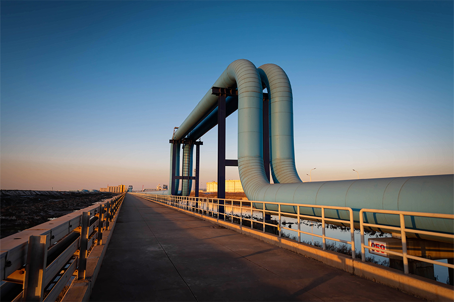
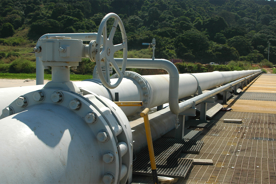
Infrastructure asset library
Make the right decisions for your network in the long-term.
The Asset Library defines the infrastructure components used in feasibility studies and network planning. It provides a structured framework for describing the technical and economic characteristics of assets used across different infrastructure projects.
While the parameters used to describe an asset vary depending on the infrastructure type (for example, power lines versus pipelines), each asset class follows a consistent configuration approach. Within a given class, users can select from standard assets provided in Continuum Industries’ library or create and customise their own assets to match project-specific requirements.
Asset parameters capture key technical characteristics such as structures, materials, and important geometric constraints, including minimum and maximum angles, clearances, and offsets. The library also incorporates factors related to construction feasibility as well as cost components, including CAPEX and OPEX.
Asset configurations can be reused across multiple projects, providing a consistent foundation for preliminary technical feasibility analysis and early-stage cost assessment.
Parametric asset definitions
- Support for above-ground and underground infrastructure
- Definition of asset types such as substations, pipelines, cables, compressor stations, and transmission structures
- Configurable technical parameters including capacity, spacing, geometry, and construction attributes
Network intervention modelling
- Extension of existing infrastructure
- Reinforcement or upgrades of existing networks
- Development of entirely new infrastructure systems
Reusable organisational libraries
Asset definitions can be reused across projects and teams, ensuring consistent engineering assumptions across an organisation.
BIM-aligned metadata
Asset parameters follow structured metadata principles aligned with Building Information Modelling (BIM) practices and can be mapped to IFC property sets, supporting downstream integration with BIM and CAD systems.
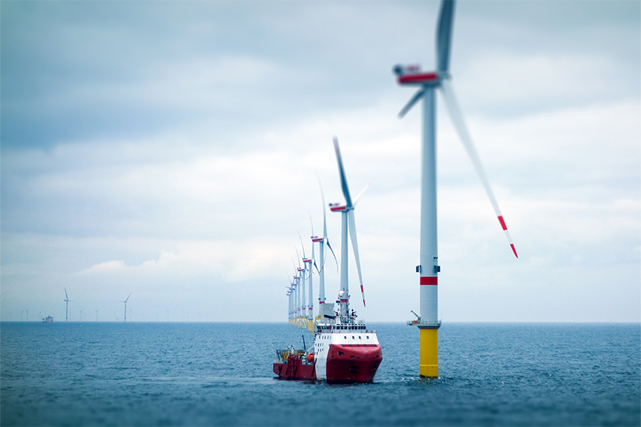
Large-scale spatial optimisation
Make the right decisions for your network in the long-term.
Optioneer includes a spatial optimisation engine for evaluating infrastructure siting and network expansion strategies.
The system analyses spatial constraints, infrastructure requirements, and project objectives to generate feasible and optimal development options.
Supported workflows include:
- upgrades to existing infrastructure
- expansion along existing rights-of-way
- parallel routing alongside existing corridors
- greenfield infrastructure development
- siting of new infrastructure near existing utilities
- evaluation of development opportunities at parcel level
Cloud-scale spatial analysis
Complex optimisation workflows are executed in the cloud without requiring local computational resources.
Automated option generation
The system processes spatial datasets and produces feasible corridors, routes, and alternative options.
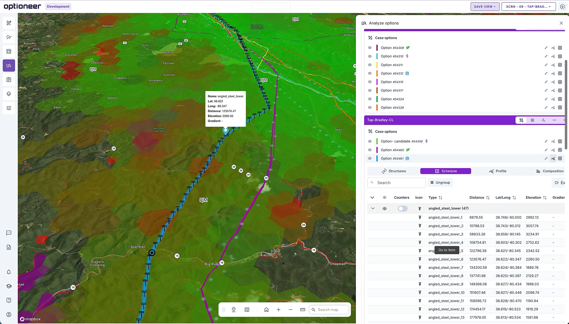
Transparent decision logic
Every generated option includes a full audit trail, including:
- constraint maps
- weighting factors
- strategic corridors
- option alternatives
- crossings and infrastructure interactions
Infrastructure-aware outputs
Results include not only shapes on the map but also locations of key structures, crossings, and infrastructure components.
Multi-criteria decision analysis and quantity take-off
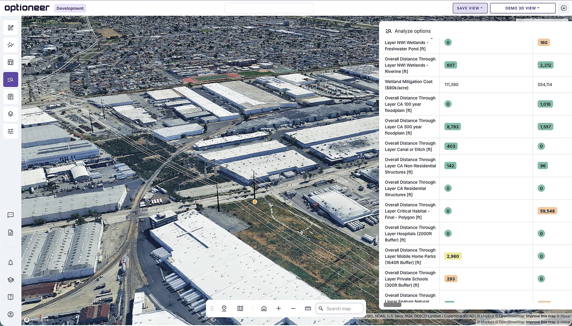
Optioneer enables quantitative comparison of development options across technical, environmental, and financial criteria.
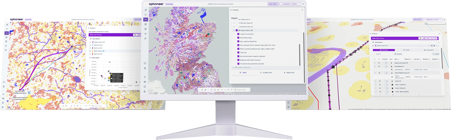
Reporting on detailed impacts
Optioneer provides tools for analysing and documenting the impact of new infrastructure, supporting internal documentation and drafting of statutory documents.
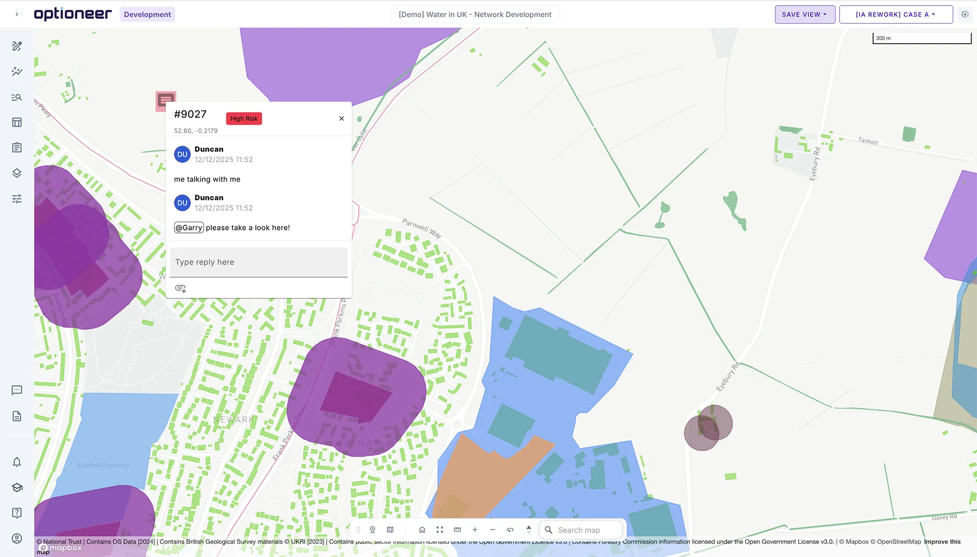
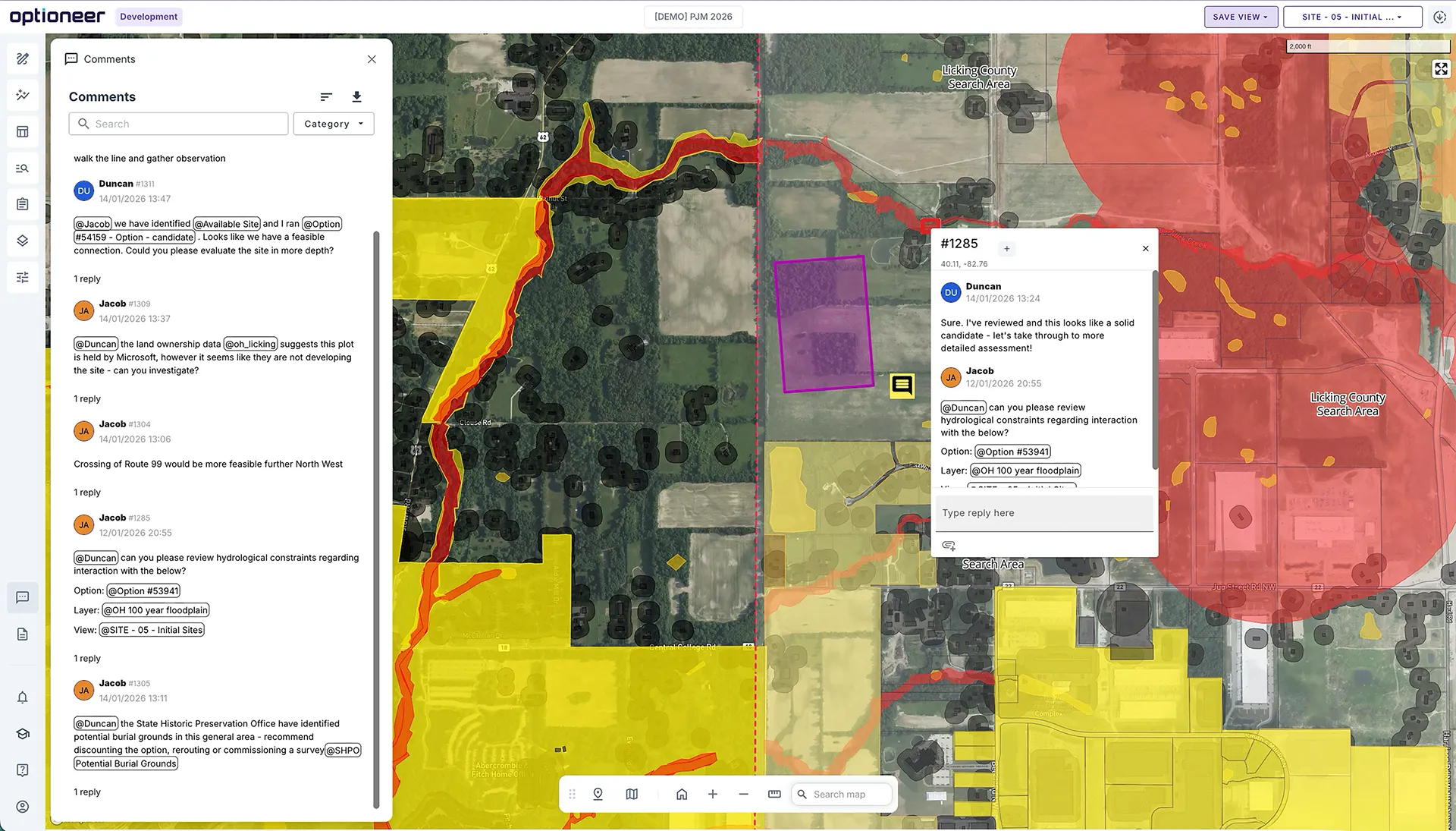
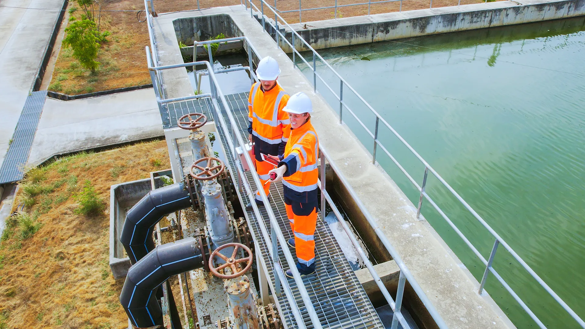
Collaborative workflows across disciplines

Make the right decisions for your network in the long-term.
Optioneer supports collaboration across engineering, planning, environmental, and regulatory teams. The platform enables organisations to work together seamlessly across disciplines while maintaining clear oversight of project data and decisions.
Granular access controls allow organisations to manage permissions through SSO-based provisioning, with roles ranging from read-only access to full administrative control. This makes it possible to create secure workspaces for internal teams as well as collaborative environments with third parties, such as engineering consultants or external advisors.
Optioneer can also be used during workshops, meetings, and presentations to facilitate discussion and gather input from subject matter experts. In addition, the platform provides a structured environment for documenting project decisions and maintaining a transparent record of the decision-making process.
Interactive comments, tagging (with notifications) and directly on the map, with live links to specific impacts or layers
Use of collaborative saved views / metrics for various disciplines, allowing to create full narratives
Iteration on the result - change line and structure locations, save and re-run
Rapid setup of project spaces when new projects spin up - available to start work within minutes!

We can run a route in half a day with Optioneer compared to weeks with GIS only. As well as saving us a considerable amount of time, the platform took away a lot of the desk work and allowed our specialists to focus on what they do best. It gave us the knowledge and confidence we needed going into the HND exercise. The platform itself is visually impressive and has proven a helpful collaborative working tool for external stakeholder interactions, as well as internal multi-disciplinary meetings.
How can Optioneer help you?
Learn more about our product offering and the benefits to your project planning.
Client success stories
We’ve had the pleasure of working with global leaders in the utilities industry, find out how they achieved results with Optioneer.


We will be in touch with you shortly.