Optioneer for Development
Take a project from concept to delivery substantially faster than with traditional methods. Leverage data, automation and transparent decision making to de-risk your project.
Introducing Optioneer for Project Development.
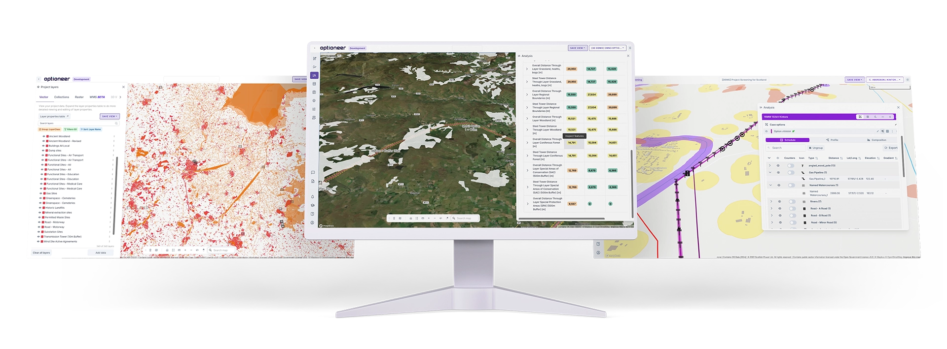
Optioneer for Project Development supports in-depth analysis of options, over time. Your in-house team and consultants can use Optioneer for Development to ensure that your projects meet thier milestones throughout the development process.
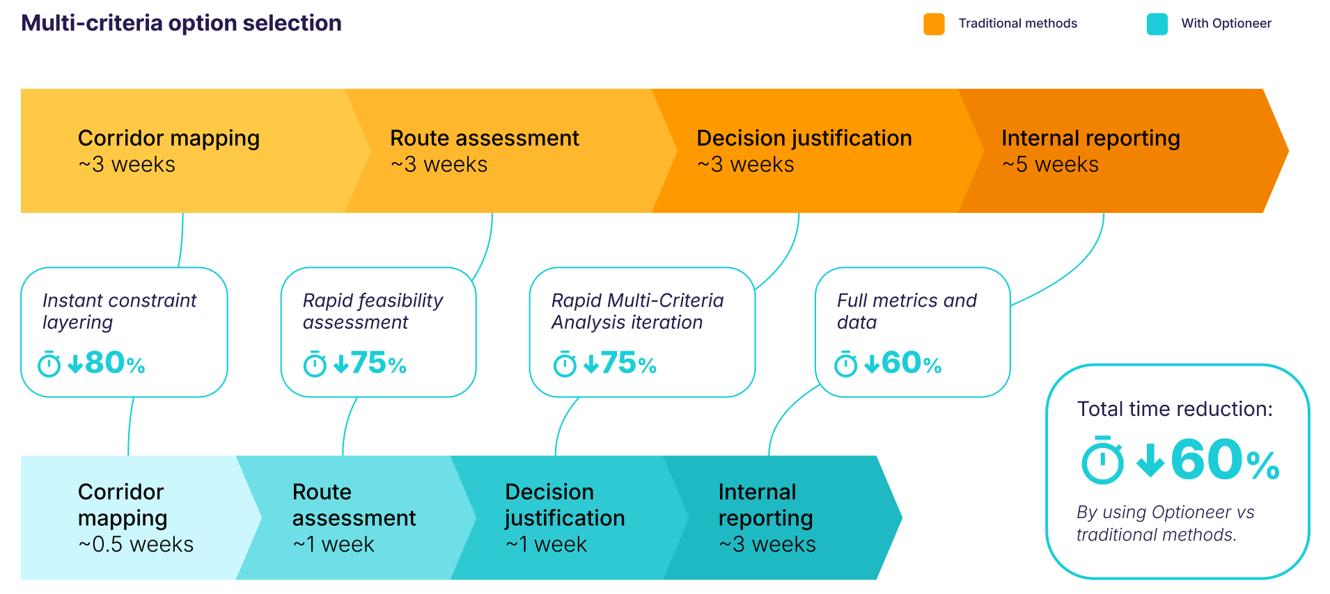
Within a specific project area you can generate robust, justifiable and auditable decision making, with rapid iteration powered by automated workflows. Optioneer allows for a rapid start and a solid base, as your project prepares for planning approval.
Outputs are highly detailed early on in the process. Providing you with a long-term audit trail methodology and full reporting over the project timeline. Ideal for public and stakeholder engagement, preparation for field surveys, permitting, EIA and detailed design.
Real-world projects using Optioneer for Development
Here are just some projects that are progressing towards delivery, using Optioneer.
Read our customer stories to find out more.
Fred. Olsen Seawind and Vattenfall JV reference Optioneer in their Development Consent Order (DCO) application, describing the methodology for selection of grid connection.

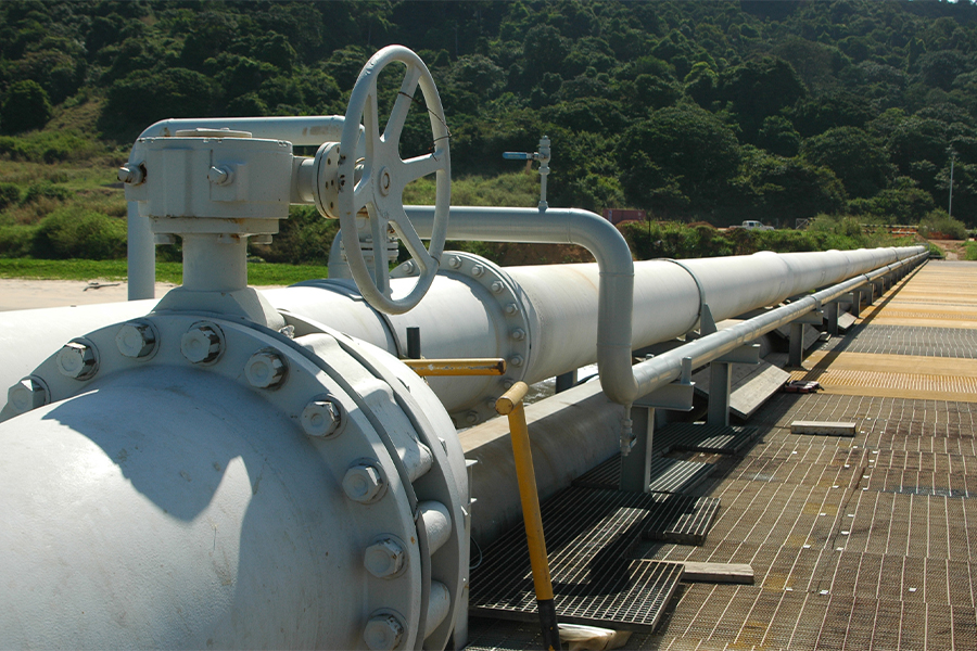
Optioneer was used to develop over 500km of strategic pipelines in East Anglia. The first phase of the project is already constructed, with the second expected by 2030.

Creag Dhubh - Inveraray 275kV project used Optioneer for evidence-based justification of project decisions during a Public Local Inquiry. The project successfully received consent.

Chleansaid Wind Farm Connection
required over 10km of 132kV, wood pole, transmission line to be constructed. The wind farm received consent in 2023 while the connection took until 2026.
Spittal - Loch Buidhe - Beauly Connection is a 400kV, 191km, transmission reinforcement project. The project recently submitted their Section 37 application, referencing Optioneer.

National Gas completed an in-depth study on a retroactive project, quoting 93% time savings in using Optioneer. The project was completed with funding from Energy Networks Association.
Use Cases
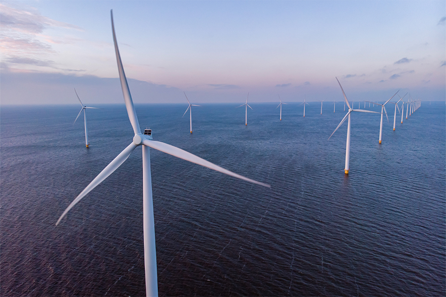
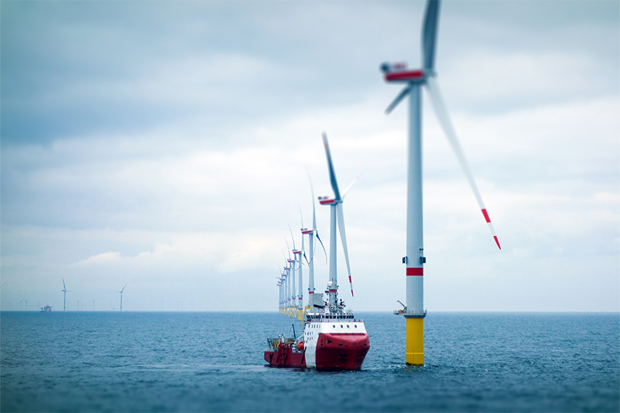
Optioneer for Development is a valuable tool for a range of different specialists including: project managers, engineers, environmental and permitting specialists and public relations experts. These use cases apply across multiple sectors - Optioneer has been used by power utilities, renewable developers, gas networks and water networks.


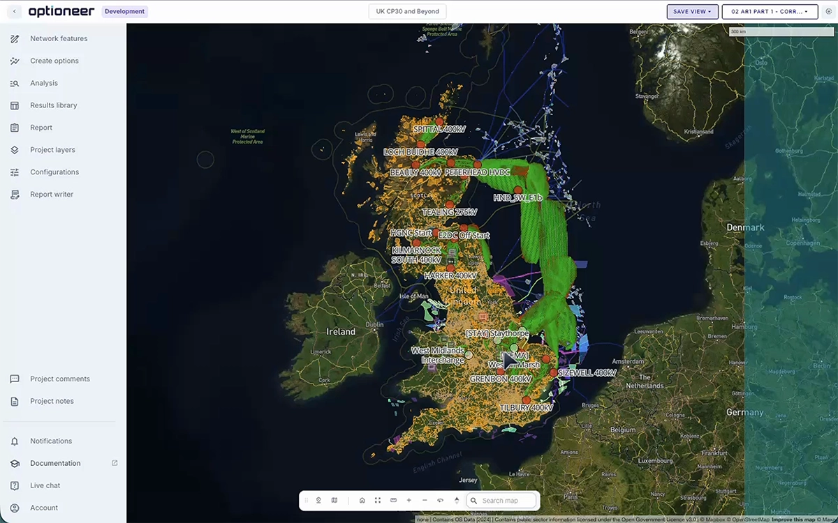
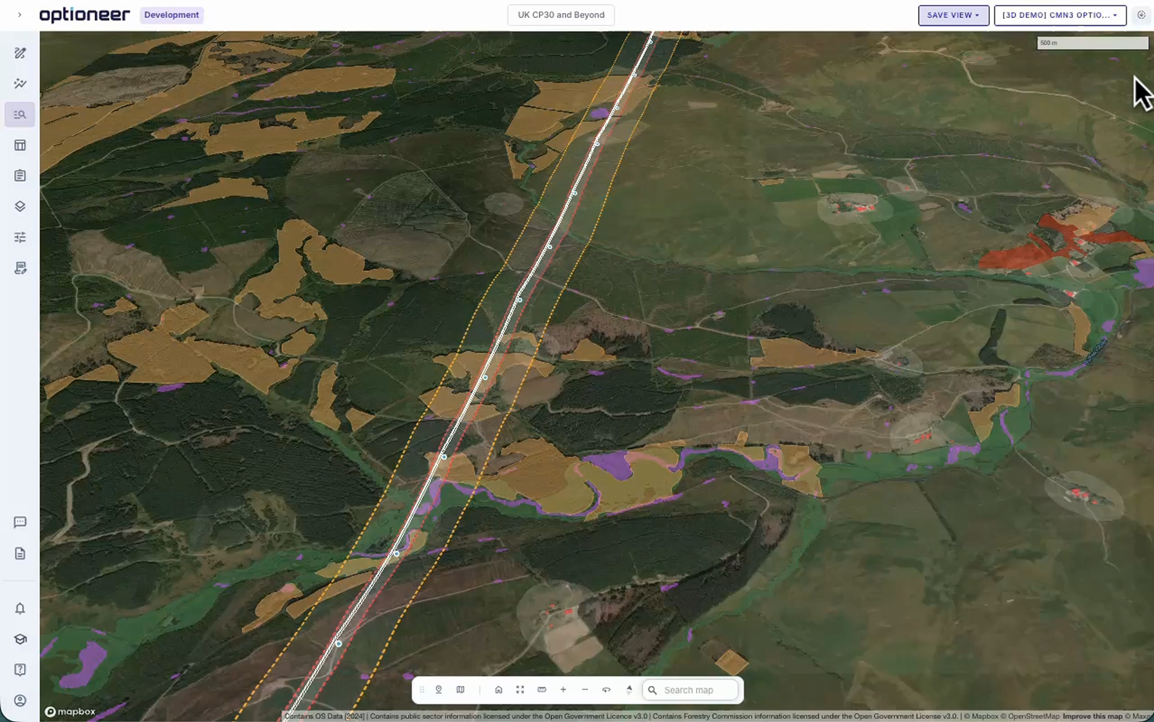
Constraint mapping and option development
Mobilize your project quickly, using an established and tested methodology.

Title
Optioneer combines a state-of-the-art geospatial database (with over 12,000 sources), curated and updated automatically. This allows to mobilise new project development rapidly and using a predictable, tested best practice.
Constraints that include environmental, socio-cultural, physical infrastructure, hydrology (and many more), form a solid basis for initial desktop mapping of strategic options. Constraint weightings are agreed with subject matter experts (and linked to relevant legislation) and re-used throughout the process.
For more information on our database and the process behind sourcing the data, see our data offering page.
Get to initial strategic corridor options within a few hours and complete the initial study within weeks.
Combine geospatial data from statutory sources to de-risk long-term development early.
Use a consistent methodology and technical/cost parameters for various project types.
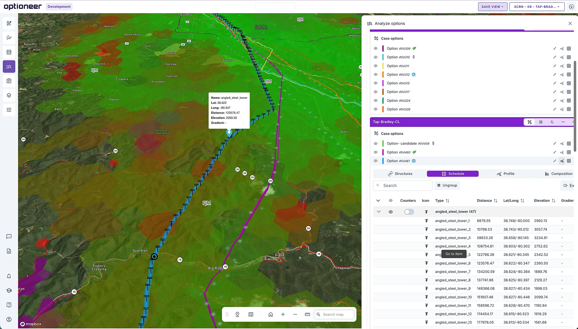
Project setup in Optioneer
Constraint configuration
Corridor generation


Multi-criteria option selection
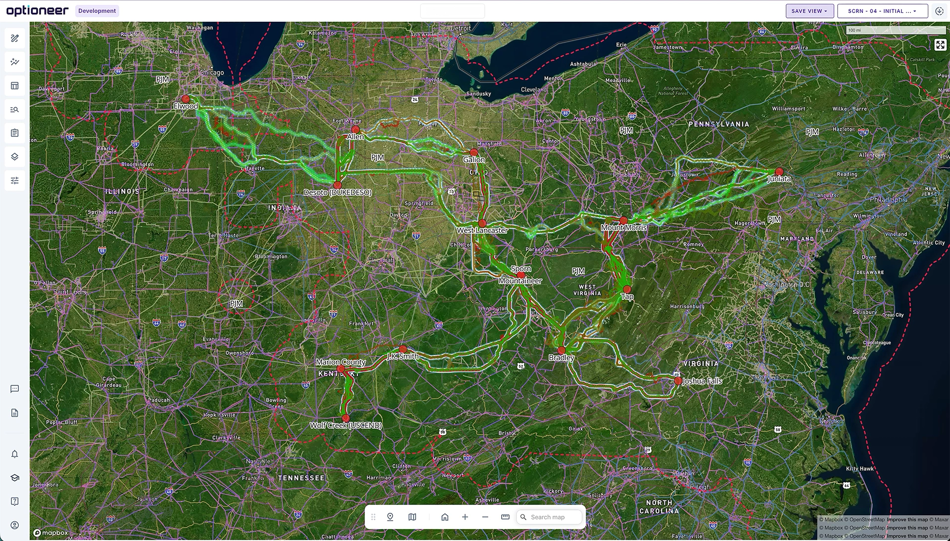
Automate repetitive tasks to focus on key project challenges.
Title
Geospatial data, combined with clever algorithms and a suite of granular technical, risk and cost parameters, allows for automation of repetitive processes which underpin multi-criteria option assessment.
The system utilises, among others, optimisation logic aimed at minimising impacts on constraints (based on weightings), selection of optimal asset type or construction method for the area, CAPEX & OPEX calculations and logic allowing to take advantage of existing land rights or assets.
This logic is combined into key metrics, from thousands of granular, individual impacts, to key strategic insights related to technical feasibility, economic cost and impact on the environment and society.
Assess hundreds of options against thousands of metrics using inputs from all disciplines.
Generate brand-new options, evaluate existing ideas or define new manually.
Create in-depth inputs to reports - from engineering to environmental screening.
Option generation
Constraint configuration
Draft written report
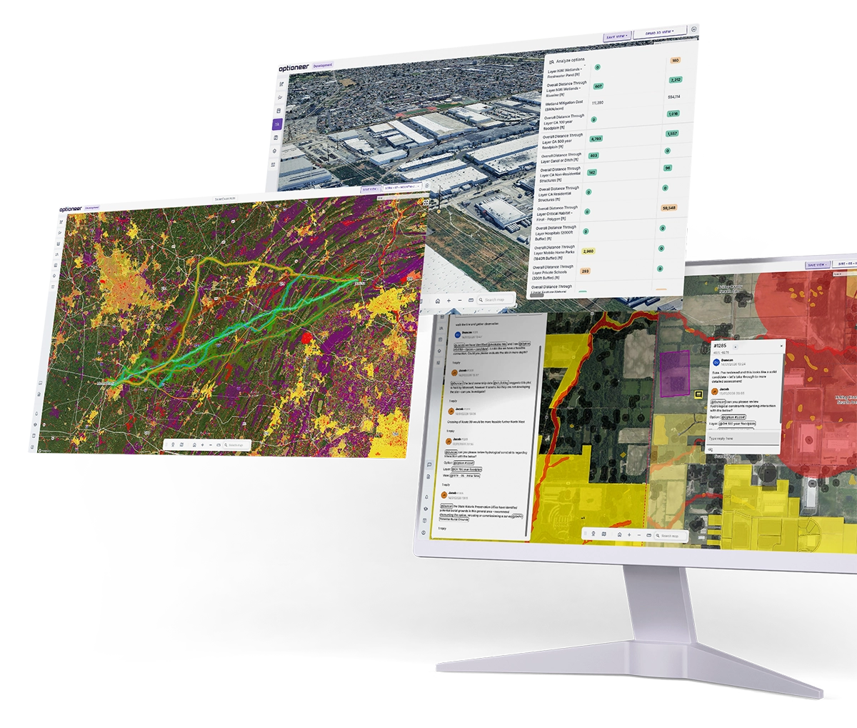
Public consultation & stakeholder engagement
Use engaging vizualisation, informative reporting and real-time feedback capture to go through the planning process more smoothly.
Title
Optioneer helps to prepare engaging, transparent and informative materials for public consultations and conversations with statutory stakeholders. The main benefit is in speeding up iteration; projects spend years in development and suffer from small changes which compound over time.
Immersive web-mapping environment allows for informative visualisation of key aspects of the development in 3D, capturing comments on the project in real time.
Automated report writing, based on stakeholder or company templates, allow quick preparation for discussions and a solid basis for responding to challenges around the project.
Quickly prepare information required to align stakeholders and get public buy-in.
Develop immersive, 3D, photorealistic ‘fly through’ of your project.
Significantly speed up the iteration or evidence preparation process in case of legal challenges.
Create a route flyover
Capturing comments in real time
Setting up evidence-based decision making


Optioneer helped the project overcome a programme risk and provided detailed overhead line (OHL) alignment options for the proposed wind farm development. The process significantly reduced traditional timescales required for detailed OHL routing and the team at Continuum effectively adapted to the project needs, delivered on time and provided excellent support following the completion of the OHL alignment options.
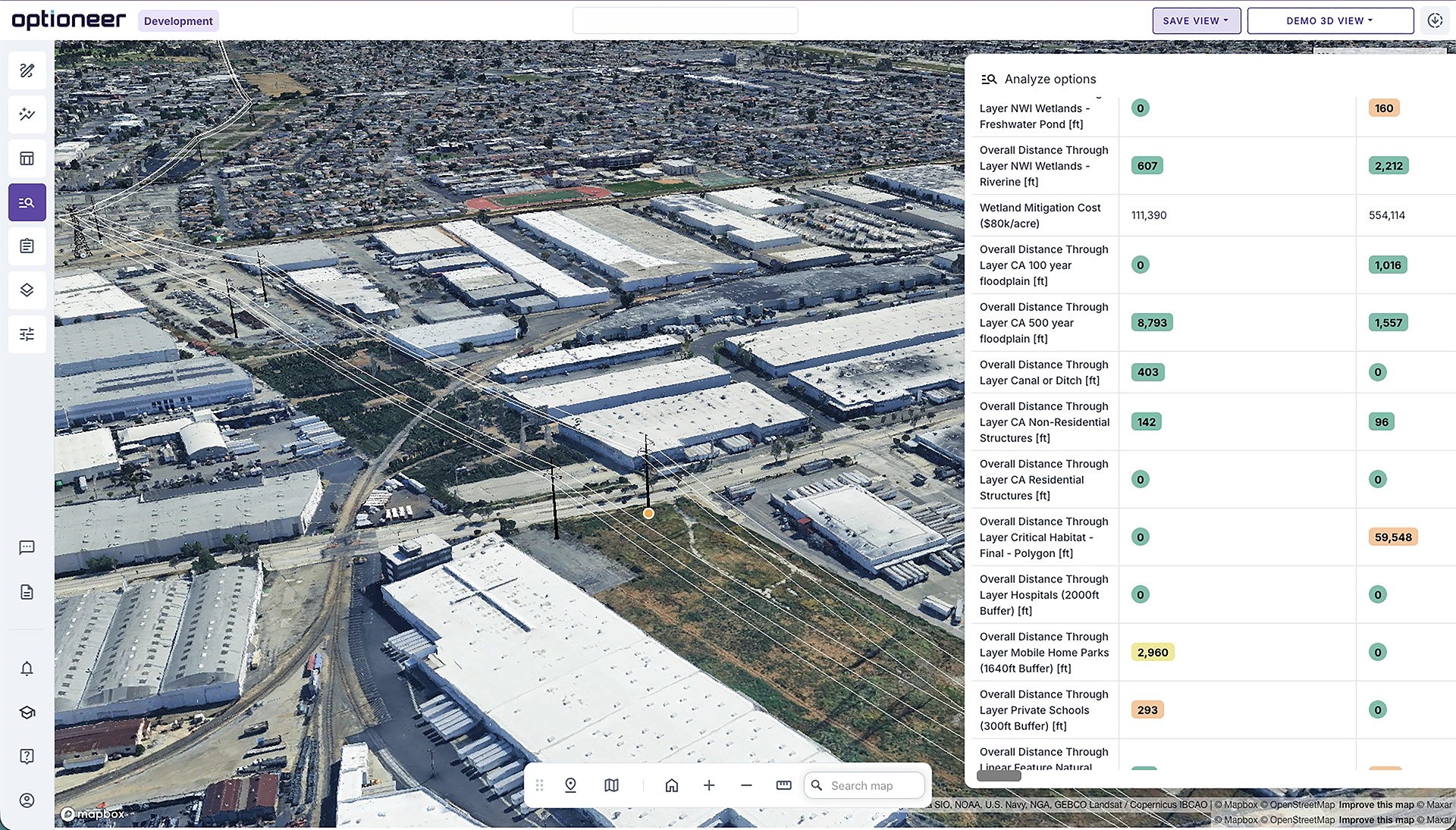
Environmental, Permitting & Land Intelligence
Streamline the planning process by de-risking early in the project.
Title
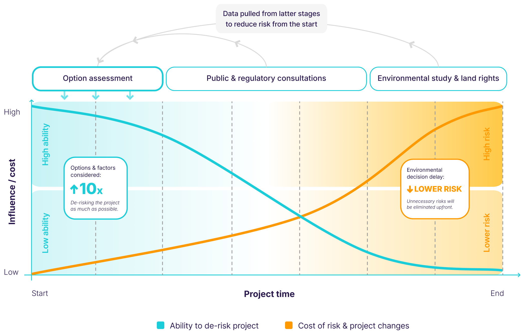
Optioneer identifies baseline environmental, permitting and land requirements at the very early stages of option development; as a result, options can be chosen to minimise the risk of delay at this stage of this project.
Legislation relevant to environmental challenges and permits is translated into a set of weighted constraints and parameters (e.g. proximity distances that trigger a permit requirement) and through use of multi-criteria analysis, risks are compared against one another.
As a result, work on obtaining permits or carrying out environmental assessment can be partially automated and front-loaded. This results in a potential reduction of risk in later development stages.
Moreover, in the US, Optioneer also comes with a complete land parcel dataset, which includes consideration of easements and land negotiations at the very start of development process.
Optimise routes and sites based on their environmental impact
Identify permitting requirements and constraints early on
Assess access and land availability, and depending on data quality, individual land parcels and owners impacted
To record changes to alignment (and reasons behind them)
Full re-run of the original analysis
Automated generation of draft, desktop EIA chapter
Optioneer has greatly accelerated our routing process, which has been a significant advantage for the East Coast Hydrogen project. In the past, it would take us an entire month to develop just one route, but with Optioneer, we can generate multiple routes and alternatives within a matter of days. The convenience of having all the work consolidated on one platform has been incredibly valuable to us.
Accelerate your planning.
Explore more, de-risk faster, and move forward with confidence.
Screening to Development evolution
Many of our customers see a natural evolution from Screening - where they look at a vast array of feasible options - to Development - where they take those options forward for more detailed assessment. As a result customers can get discounted prices on Optioneer for Development if they have already been using Optioneer for Screening.
Client success stories
We’ve had the pleasure of working with global leaders in the utilities industry, find out how they achieved results with Optioneer.


We will be in touch with you shortly.