What can you achieve with Optioneer? From automated network scenario and site selection to reporting, public consultation and more.
Optioneer is a hugely flexible platform that supports a vast range of use cases, across multiple of industries, team and client needs.
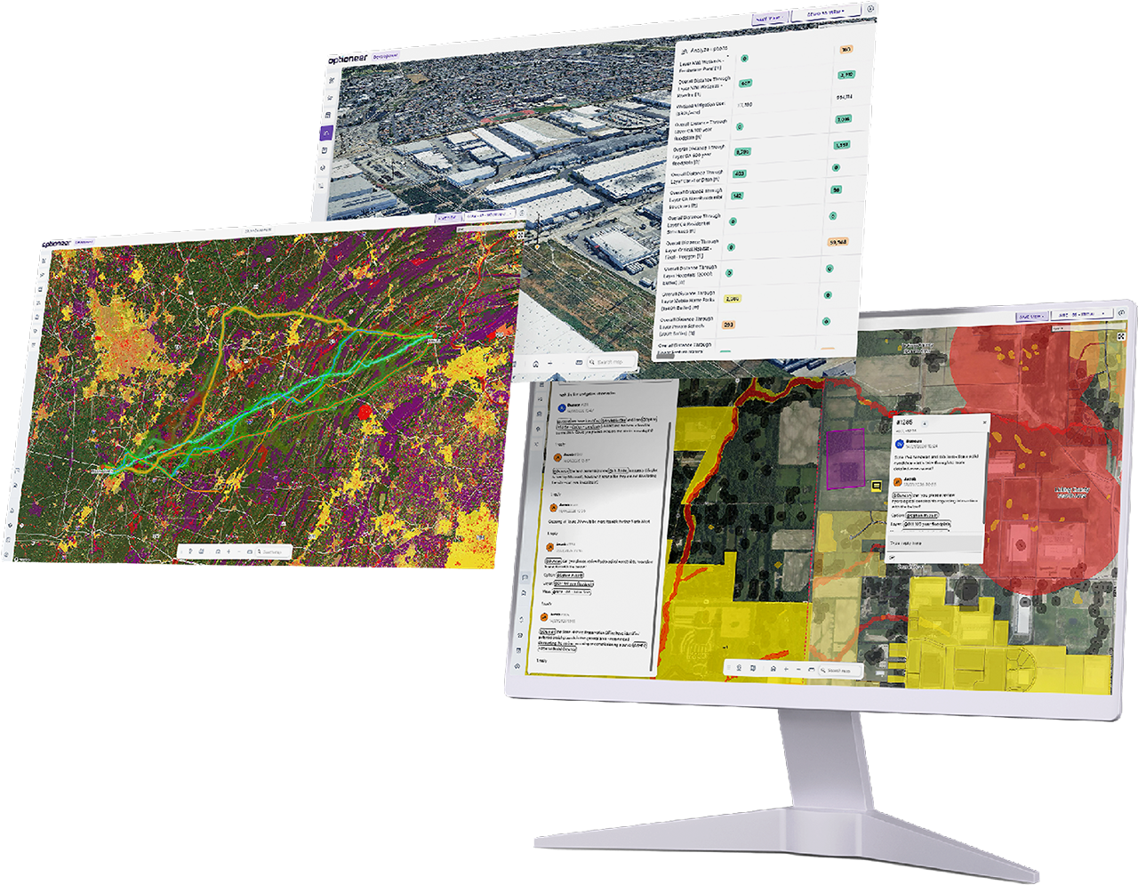
While our platform is technically equipped for screening and development of network scenarios, corridor and site selection, our uses go far beyond that. From system planning and scenario modelling, competitive tender bid development, cost estimation and feasibility, to constraint and risk mapping, route alignment and layout optimisation.
Optioneer also helps report on technical, environmental, cost, risk and permitting impacts, aids with public consultation preparation, consent and permitting applications, and project collaboration.
See what you can do with Optioneer.
Key use cases
Explore what's possible with Optioneer across a wide range of project types and use cases.
Network & portfolio
Plan, model, and prioritise network infrastructure projects at scale.
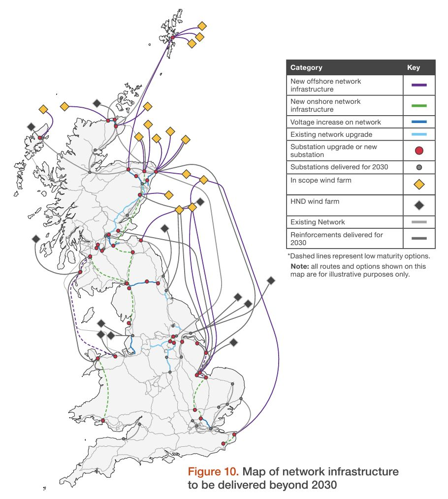
Long-term network development planning
Evaluate future network reinforcement needs across any territory. Compare connection scenarios and investment timing against required reinforcements, all informed by real-world context.
British utility uses Optioneer to bring network plans up to three years early.
System planning & scenario modelling
Run multiple high-fidelity "what if" network configurations. Compare strategic options and stress-test configurations before locking into a long-term development path.
If you or your team uses packages such as:
Plan OS & PSLF by GE Vernova
PSSE by Siemens
PROMOD by Hitachi
PLEXOS by Energy Exemplar
you can use Optioneer to support rapid feasibility evaluations when modelling various scenarios for your system.

Multi-vector corridor planning
Assess shared or colocated corridors across electricity, hydrogen, CO2, and water infrastructure - all within the same territory - so you can easily identify cross-asset conflicts and infrastructure opportunities.
Currently used in England and Scotland by gas, water, and electricity providers. Optioneer facilitates alignment between private developers and national utilities to optimise regional CO2 export and resource sharing.
Portfolio prioritisation & sequencing
Move from project-level data to program-level intelligence. Rank and sequence multiple projects within a capital program based on real-world cost, risk, and deliverability metrics.
A major UK water utility uses Optioneer to prioritise their mains’ replacement initiatives — adding real-world feasibility information to their decision making process.
Enhance your decision-making by using Optioneer in conjunction with tools like Optimatics and Copperleaf.
Commercial & competitive
Bid, plan, and use existing assets with confidence.
Competitive tenders
Win bids with Optioneer.
Fast-track proposals for competitive tenders by evaluating route and site options quickly and in detail. Delivering solid information on cost, technical feasibility, and impact means you can have full confidence in the deliverability and accuracy of your pricing and proposals.
The graph shows the increase in usage of Optioneer during the PJM competitive 2025 RTEP Window 1. Optioneer allows these utilities and developers to quickly generate and evaluate options during these tight windows, to confidently present for competitive tenders.
Average distance evaluated per week (miles)
PJM competitive 2025 RTEP Window 1

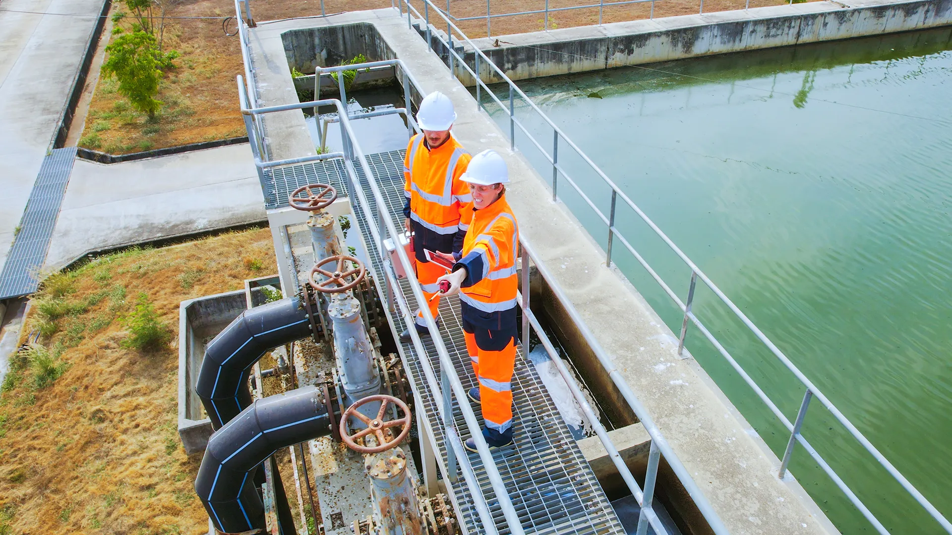
Connection & grid
Screen grid connections, corridors, and landfall sites fast.
Grid connection assessment
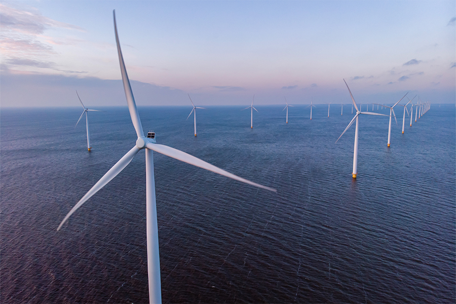
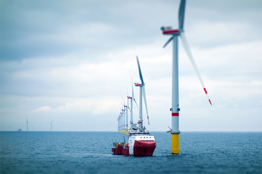
Identify and evaluate grid connection points, interconnection nodes for renewable energy projects (including landfall locations for offshore wind).
Optioneer provides a geospatial lens for renewable projects, evaluating sites against potential development and routing constraints before capital is committed.
Following recent planning denials by the Scottish Government due to insufficient connection assessments, integrating grid evaluation into early-stage site selection is no longer optional—it is a project-critical requirement.
Strategic corridor identification
Rapidly generate and compare broad route corridors at scale. Establish viable development zones between origin and destination points before moving into detailed routing.
A major European transmission system operator used this capability to evaluate at a country-scale, over 10,000km of strategic corridors for hydrogen network evolution across multiple future network scenarios.
Project siting
Screening potential sites for converter stations, substations, and cable landfall points based on technical, environmental, and land-use constraints.
The Muir Mhòr team assessed 17 landfall and 5 substation locations—resulting in dozens of possible combinations—within just 8 weeks.
Offshore-to-onshore screening
A single, integrated analysis from seabed to grid. Bridge the gap between marine geology and terrestrial routing. Optioneer produces hybrid feasibility assessment spanning seabed geology, offshore constraints, landfall options, and onshore routing in a single integrated analysis.
SSE Renewables developed a standardised process for this complex task by utilising a set of nearly 100 metrics within Optioneer, ensuring consistency across unusual offshore-onshore transitions.


Constraint analysis & risk
Map constraints, risks, and cumulative project impacts.
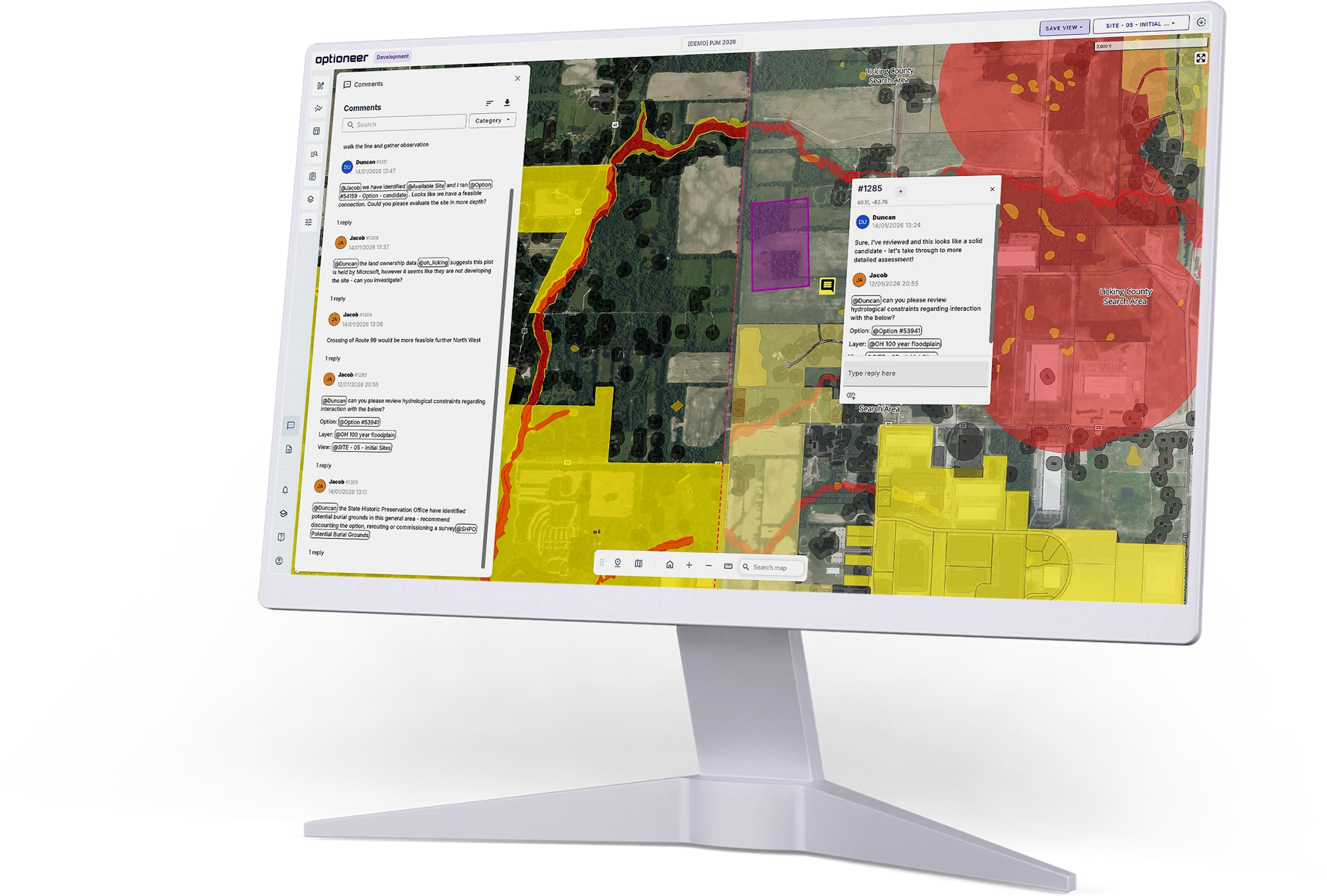
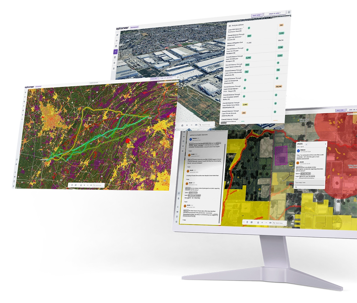
Constraint & risk mapping
Build your project on a unified source of truth. Aggregate and visualise every spatial constraint—environmental designations, land parcels, transport, existing infrastructure, and topography—into a single, unified project view.
Every project in Optioneer starts here. 97% of project data is powered by Continuum Industries’ proprietary library and strategic data partnerships, ensuring you never start from a blank map.

Cumulative impact assessment
Navigate regulatory hurdles and mitigate legal risk. Evaluate the combined effects of your proposed project alongside other planned or existing developments. In an era of increasing regulatory scrutiny and legal challenges, this isn't just a feature—it's your project's insurance policy.
A major Transmission Owner in Scotland used Optioneer across 10 projects, including a 500km, 400kV portfolio. By automating early-stage assessments, they achieved significant time savings while drastically enhancing the quality of early stage assessment.
Route & asset design
Optimise routes, assets, and site layouts down to granular detail.

Detailed routing & alignment
Transition from strategic corridors to specific route alignments. Optimise paths at a granular level against all weighted constraints. Achieve expert-level routing in a fraction of the time without sacrificing quality.
In an official Energy Networks Association study, National Gas observed a 93% reduction in routing time using Optioneer. With the Optioneer software-generated results closely matching expert-designed routes.
Asset type selection & hybrid design
Determine the optimal mix of overhead, underground, and subsea assets. In Optioneer you can switch asset types based on topography and environmental constraints to ensure your cost estimates reflect reality before they hit the field.
A British utility could have avoided an £11m miscalculation between strategic project selection and later development by using Optioneer. After a route length assumption failed to account for a 2km underground section in an Area of Outstanding Natural Beauty—a risk instantly mitigated by Optioneer.

Technical feasibility assessment
Verify engineering viability before breaking ground. Topography analysis, ground conditions, pylon/tower placement feasibility, and construction access within a single project space.
A California-based utility uses Optioneer to evaluate the viability of following existing rights-of-way while upgrading assets from 138kV to 220kV, ensuring any new assets avoid constraints that have arisen post-completion of the existing line.
Siting & layout optimisation
Detailed siting for point infrastructure and substation footprints. Optimise the placement of substations, converter stations and compressor stations by considering local constraints, visual impacts and connection feasibility.
A US developer leverages Optioneer to determine the viability of voltage upgrades. By modeling the expanded footprint required for higher voltages, they can demonstrate the exact siting impacts of upgrading an existing facility.
Assessment & reporting
Automate reporting, environmental risk, and land impact analysis.
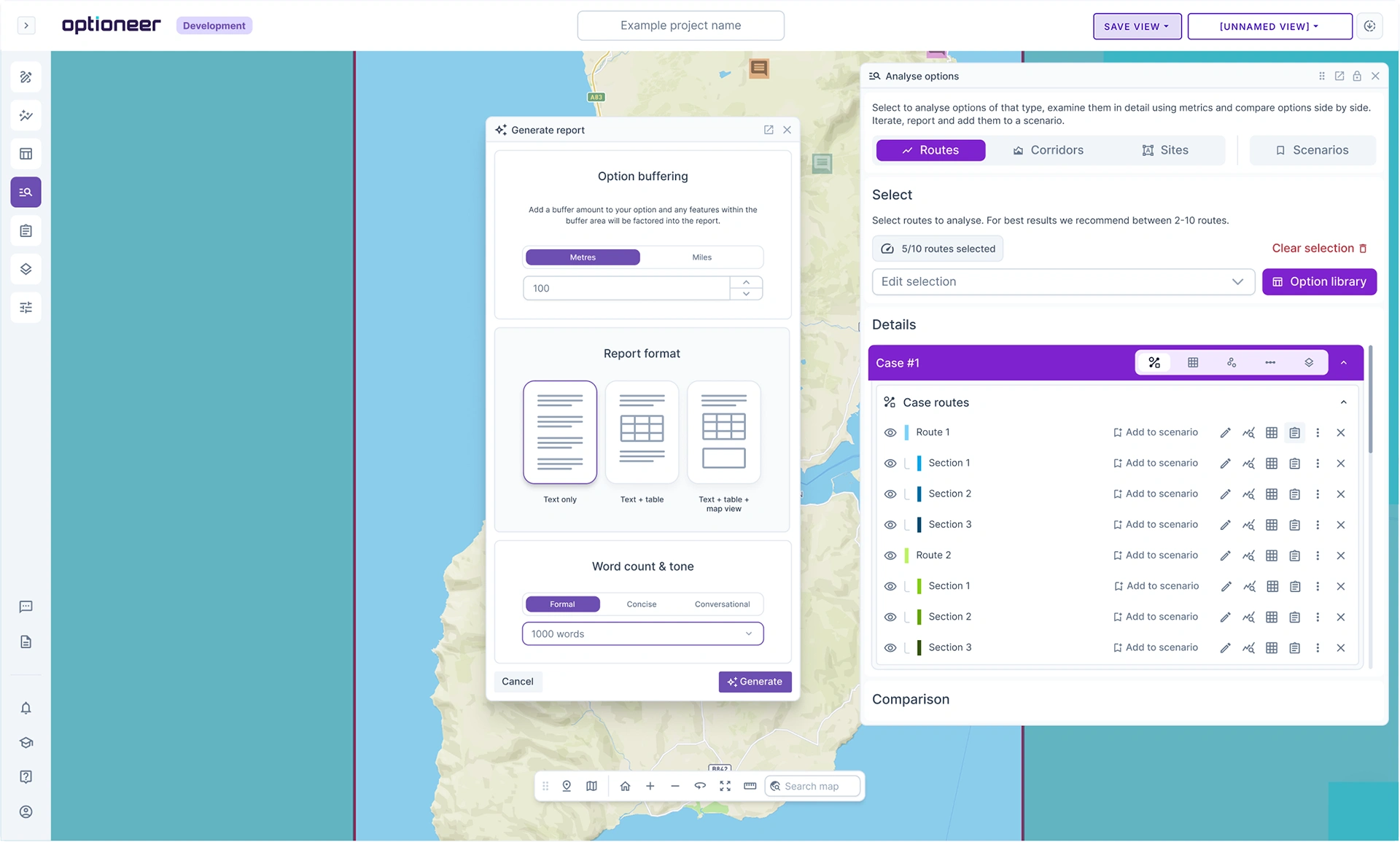
Automated option appraisal reporting
Generate structured comparison reports. Using RAG (Red-Amber-Green) metrics, cost breakdowns, and impact summaries for each route option to support internal decision-making and regulatory submissions.
Optioneer’s outputs are more than 80% aligned with the reporting requirements of all major British utilities. For Californian utilities, users have achieved more than 60% automation in their reporting workflows.
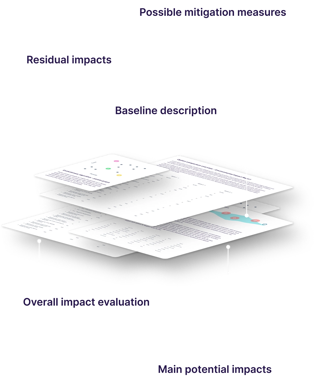
Automated reporting
Justify decisions and streamline workflows with Optioneer’s automated impact reports, RAG metrics, and custom analyses, which transform data into actionable insights.
Optioneer uses the data and structured analysis to provide outputs that can be shaped into technical, cost, environmental, permitting or stakeholder reports.
Geospatial analysis and output data are combined into a compelling narrative that users can interact with. Outputs are linked to data layers that are linked to policy, permits and engineering standards, allowing the generated text to be enhanced with a lot of rich context.
Landowner & land parcel impact analysis
Quantify the number and extent of land parcels crossed by each route option. Support of wayleave/easement negotiation and compensation strategy with real world data.
Thanks to partnership with Regrid, Optioneer can produce land owner and land parcel reports within the platform, helping utilities maximise use of their existing properties and easements.
A wealth of pre-loaded GIS data at your fingertips
Our data library is extensive, in-depth and up to date. Infrastructure planning increasingly relies on integrating large volumes of spatial data across wide geographic areas. Optioneer provides a structured environment where teams can bring together the information needed to evaluate development options with confidence.
Stakeholder & consent
Build consultation materials and consent applications fast.

Responding to stakeholder challenges
Rapidly iterate on route alternatives in response to objections or new constraints raised during consultation. Demonstrating that alternatives have been rigorously assessed.
A Scottish customer successfully demonstrated their option selection process was rigorous and defensible, after being challenged with community-led alternatives.
Project management
Onboard teams, manage portfolios, and centralise data.
Which teams can benefit from using Optioneer?
Find out how Optioneer can help with your team’s day-to-day workload, maximise efficiency, and automate repetitive tasks so you have time to tackle the most complex challenges.


Optioneer helped the project overcome a programme risk and provided detailed overhead line (OHL) alignment options for the proposed wind farm development. The process significantly reduced traditional timescales required for detailed OHL routing and the team at Continuum effectively adapted to the project needs, delivered on time and provided excellent support following the completion of the OHL alignment options.
Sectors
Optioneer is designed for utilities and developers in the energy and water industry. Wether you are improving existing networks or developing new, Optioneer is equipped for overhead, underground and subsea transmission, hydrogen and CO2 pipelines.


Do you have a similar or new use case to deliver?
Reach out today and see how Optioneer can help streamline your project planning and development.
Client success stories
We’ve had the pleasure of working with global leaders in the utilities industry, find out how they achieved results with Optioneer.


We will be in touch with you shortly.
